Word: Ayu Arman
The Magical Land of The East
In terms of landscape, Mimika ranges from highlands to lowlands. Overlooking the Arafuru Sea, Mimika’s swampy land is covered in mangroves and sago.
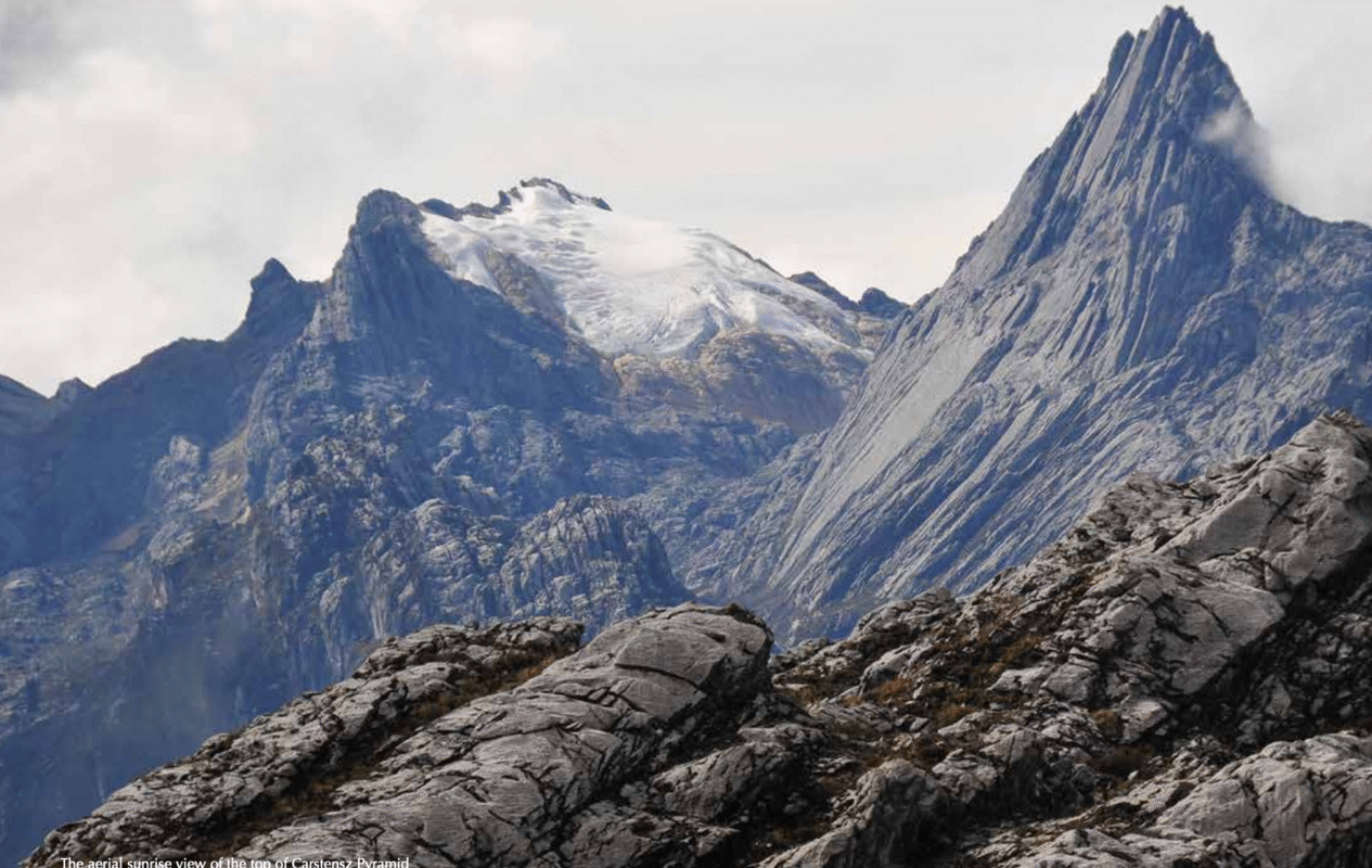
The sloping plains become a natural jungle, topped by mountains with steep slopes and snow peaks. Mimika is the only tropical snow-ice field in Indonesia.
The UNESCO World Heritage Site in 1999 designated the Jayawijaya Mountains as the highest mountain in Indonesia and the world’s seven highest peaks. The peaks include Cartensz (4,884m), Jaya (4,862m), Mandala (4,760m), Trikora (4,730m), Idenberg (4,673m), Yamin (4,535m) and East Cartensz (4,400m).
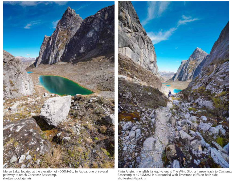
This mountainous area is also included in the Lorentz National Park, a conservation area with the most complete ecosystem in Indonesia, even in Southeast Asia. Meanwhile, the womb of Papua’s Central Mountains contains the world’s largest gold, copper and silver deposits.
Mimika is like a giant roof shading Indonesia from the east. The main pillars of the roof are constantly
shrouded in thick fog and the cold winds of eternal snow and witness the birth and growth of the Amungme, Damal, Dani, Moni and Nduga civilisations.
Meanwhile, the Kamoro tribe lives in the lowlands, which are covered in dense tropical rainforest and lined with mangroves. This tribe is known as master sea carvers and explorers.
Besides the large Amungme and Kamoro, as mentioned earlier, Mimika is also home to five kinship tribes, namely Dani or Lani, Damal, Mee, Nduga and Moni. They have their own language, traditions, rites, dance, and various types of handicrafts, ranging from intricately woven fabrics to complex wood carvings.
While Mimika has some of the most stunning natural beauty in the country and still harbours a variety of unique and exotic traditional cultural patterns, the region has yet to be touched by mass tourism like Bali.
And so, my journey begins in Tembagapura where the Amungme people were born and raised.